
From Banff to the Border: Planning for the Tour Divide
Logistics, maps, resupplies and the mental game behind the Tour Divide

In past updates, I’ve covered training, my bike, and the gear I’m bringing along on this year’s Tour Divide. But there’s one other element of prep that’s been eating up a huge chunk of my time – and that’s planning the route logistics.
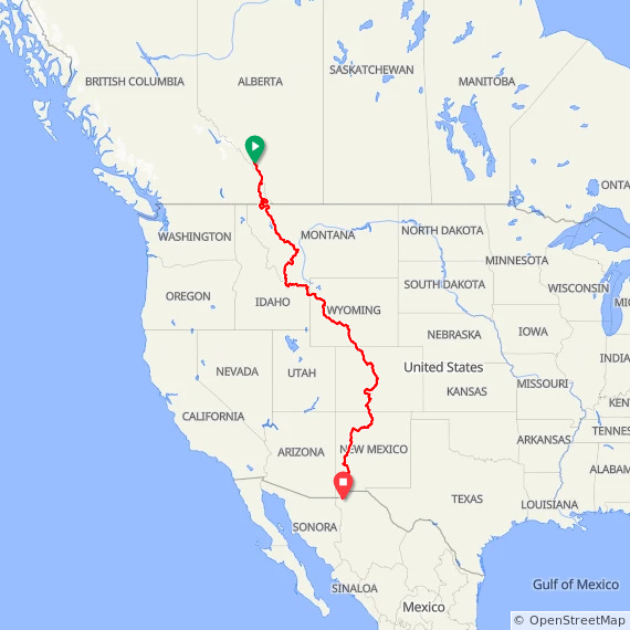
For those less familiar: the Tour Divide is a completely unsupported race. There’s a “Grand Depart” the second Friday in June – a sort of loosely-organized mass rollout when 200+ people will leave around the same time – but once you leave the start line in Banff, you’re on your own until you roll up to the lonely fence at the border crossing marking the US/Mexico border at Antelope Wells, New Mexico.
That includes figuring out:
Where and when you can find food and water
How much you’ll need to carry between resupply points
Where you might sleep (or crash) for the night
Where camping’s allowed – or definitely not allowed
What kind of surface and elevation lies between you and your next stop
How you’re getting home from the literal middle of nowhere at the finish line
…and many more things.
They say people often fall into the trap of “packing your fears” on rides like this. One of mine is running out of food or water. So instead of packing it, I tried to plan it out of existence.
Understanding the Route
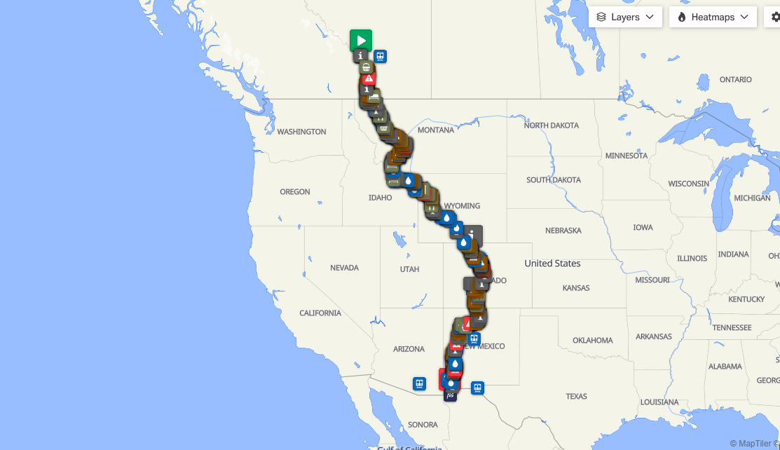
The Tour Divide runs ~4,500 km (2,750 miles) from Banff down to the Mexico border, with 70% on gravel and dirt and 30% on pavement. It includes about 50,000 m (150,000 ft) of elevation gain – roughly six trips from Everest Base Camp to the summit, if you're counting.
Unlike some bikepacking events where you pick your own line, the Tour Divide follows a set route. But that’s where the organization ends. There are no stages, no support tents, no signage, no sweeper wagons. Just you, your bike, and a lot of miles.
The official route for each year is released about a week before the start. Fortunately, past versions provide a good starting point. For my planning, I used:
A RideWithGPS map, created by a 2024 rider
Craig Fowler’s fantastic One of Seven Project planning tools
The Adventure Cycling Association’s (ACA) printed Great Divide maps – big thanks to David Stowe for lending me his set!
After merging these resources into my own custom RideWithGPS route, I dropped in milestones, restaurants, bike shops, motels – you name it.
Researching the Details
Once the rough map was in place, I went into full-on spreadsheet goblin mode.
Where exactly are the grocery stores?
What days are stores open? (And do hours change mid-week?)
Do I need to call ahead for a room or campsite?
Where are the bike shops, and when are they open?
Are the critical stops on-route or slightly off-course (and easy to miss if I didn’t mark them!)?
I added all of this as “Points of Interest” on my map, so I can pull them up quickly on the ride as I look ahead.
Planning the Logistics
Next up was building a hard copy info sheet – a lightweight, offline failsafe I can stash on my bike. It includes:
Key waypoints, their mileage and elevation
Trail surfaces to the next waypoint
Distance and climbing to the next waypoint
Grocery/restaurant/lodging opening hours and contact details
Resupply warnings before long wilderness stretches
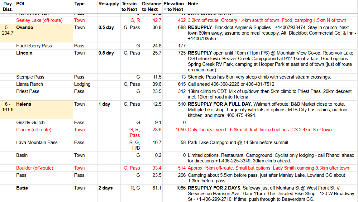
The ACA maps and One of Seven tools were super helpful again here, but I went deeper, adding additional stores, verifying closures, and identifying long descents where I can make up time. Past riders' advice – online and in person – was gold.
From all this, I pieced together a loose game plan. It probably won’t survive past day one, but it gives me a benchmark to know if I’m ahead, behind, or on track – especially important if I need to shuffle my return flight from the finish.
A Note on Resupplies
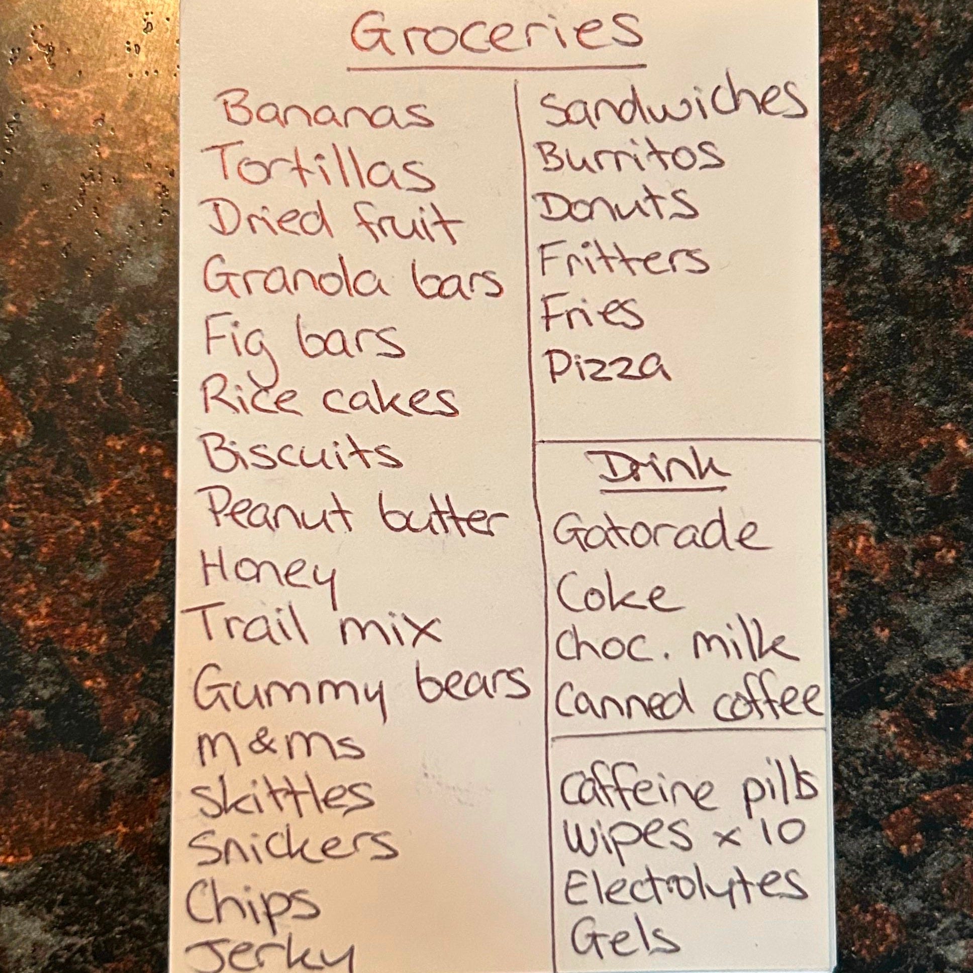
I’m no stranger to long days in the saddle, and I’ve noticed a consistent pattern on the toughest rides: my brain starts to get foggy toward the end. A personal trainer friend explained that it’s likely due to depleted glycogen stores - when your body’s running low on fuel, it prioritizes the systems that keep you moving, and cognitive function takes a back seat.
Apparently, this is pretty common, especially on multi-day efforts like the Tour Divide. That’s why I’ve tried to simplify decision-making wherever I can - starting with food. One moment that can easily go sideways is walking into a gas station or grocery store, running on fumes, and being met with a wall of choices. It’s easy to follow your cravings and come out with a pile of comfort food and not much else.
So, following Justin McKinley’s excellent advice, I put together a list of high-energy, ride-friendly foods and wrote it down in a waterproof notebook. The idea is to keep it simple: glance at the list, grab what I need, and get rolling again—no overthinking required. It’ll live in my jersey pocket for quick reference whenever I’m resupplying mid-ride.
Updating for 2025
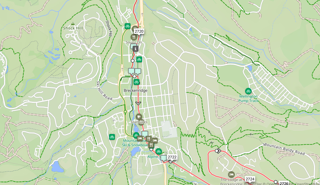
The 2025 official route dropped this week. It's mostly the same as 2024, but there’s a detour in Colorado that cuts out several prior stops.
No biggie - a few tweaks to the map and data sheet, and I was back in business.
Final Preparation
With the details sorted, it was time to finalize things:
· I split the full route into 11 segments of ~400 km each, to avoid overloading my Garmin
· Uploaded backups to a second head unit (just in case)
· Printed my info sheet on waterproof paper. It’s not elegant, but it should survive 3,000 km of grit, rain, and burrito crumbs
That’s it! Bike’s boxed. Bags are mostly packed. And in just a few days, I’ll be on my way to Banff to start this wild ride.
See you in Banff. I’ll be there Wednesday
Legend! Good luck out there!